Full Description & Details
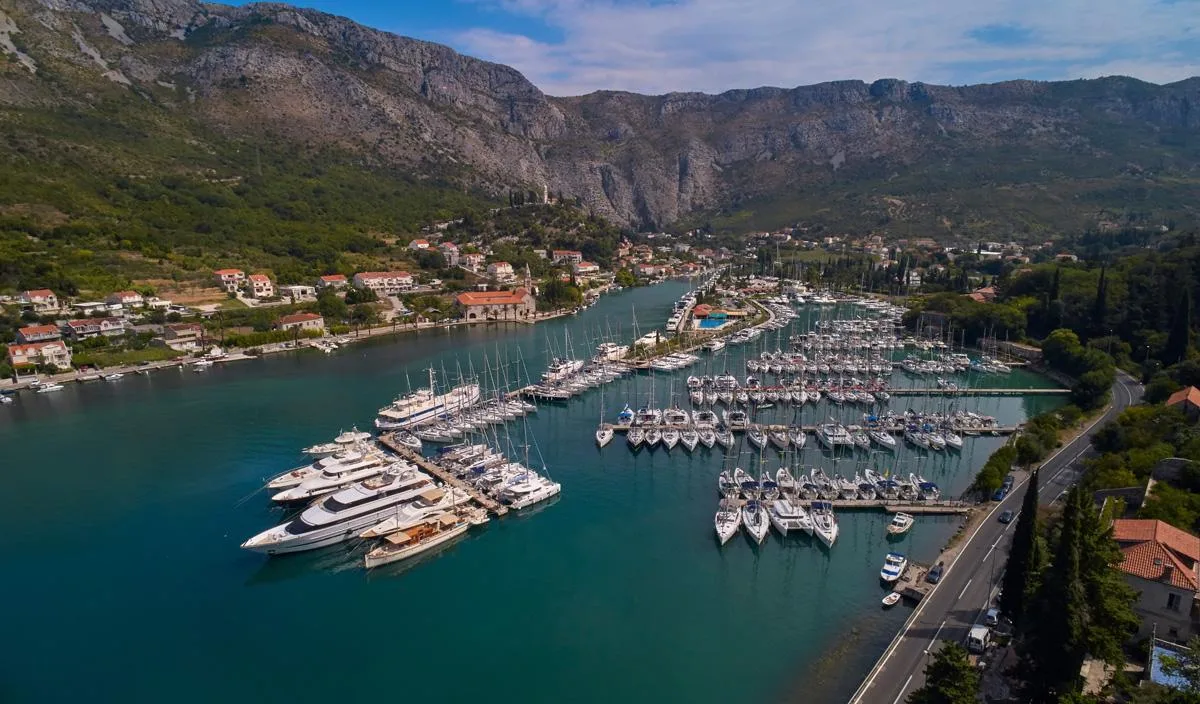
Crikvenica harbour lies on the mainland coast of the Vinodolska channel, six miles southeast of the Krk bridge. The port covers 277,070 square metres including 2,930 square metres of land and 274,140 square metres of sea area. The harbour comprises operational quays totalling 460 metres in length, a communal section with 124 berths for vessels, a nautical section with 23 berths, and an anchorage area for larger vessels. The separate Dubracina basin within the harbour provides an additional 10 berths.
Depths along the operational quays range from 3.0 to 4.5 metres, with 3.0 metres typical at the berthing areas. All berths are equipped with mooring devices, and the harbour has two harbour lights. Visiting yachts typically berth along the main breakwater past the ferry and tripper boat area, using pick-up buoys to moor bow or stern-to the quay. The harbour provides good protection from most directions but is exposed to winds from northwest round to southwest. Shallow sandbanks extend approximately 200 metres offshore on either side of the nearby river entrance, marked by red buoys to the north and a green buoy to the south.
The harbour is equipped with electricity and water supply points at the berths. A fuel station is located on the breakwater with 3.0 metres depth alongside. Near the harbour boundary at Park palih branitelja, there is a mobile ecological storage facility with containers for waste oil collection and used oil filters. Limited repair facilities are available in the small craft harbour to the southeast. The town of Crikvenica offers supermarkets, provisions shops, numerous restaurants and bars along the promenade. Vehicle rental outlets operate in town, and the island of Krk airport is 30 kilometres away with bus connections to Rijeka and Krk.
How to get there
When approaching from the north, vessels pass under the Krk road bridge with clearance exceeding 50 metres, then continue six miles southeast to Crikvenica. The town buildings and harbour breakwaters are conspicuous from distance, as is a large viaduct crossing a gorge northeast of town. Shallow sandbanks extend approximately 200 metres offshore on both sides of the Dubracina river entrance.
From the north, keep outside two red buoys marking the northern sandbank limit. From the south, a single green buoy south of the main harbour breakwater marks the southern sandbank extent. A green light tower marks the harbour breakwater end, with entrance depths of 5.0 metres.
Mariners should watch for shallows marked by two lit posts northwest of the main breakwater and a cardinal marker east-southeast of the breakwater. The harbour is managed by Lucka kapetanija Rijeka – ispostava Crikvenica and can be contacted at +385 51 242 321 or +385 51 241 577. The fuel station is located immediately west of a second green light on the west side of the river mouth.
Road access connects to Rijeka with onward domestic and international rail connections to Zagreb, Trieste, Ljubljana, Vienna, Munich and Salzburg.
Frequently Asked Questions
How many berths are available at Crikvenica harbour?
Crikvenica harbour has 124 berths in its communal section for visiting and local vessels, plus 23 berths in the nautical section and an anchorage area for larger vessels.
What is the depth at Crikvenica harbour berths?
Depths at Crikvenica harbour range from 3.0 to 4.5 metres along the operational quays, with 3.0 metres typical at the berthing areas along the breakwater.
Can I stay overnight at Crikvenica harbour?
Yes, overnight stays are permitted at Crikvenica harbour. Visiting yachts berth along the main breakwater using pick-up buoys to moor bow or stern-to the quay.
Is fuel available at Crikvenica harbour?
Yes, there is a fuel station on the breakwater at Crikvenica harbour with depths of 3.0 metres alongside, located immediately west of the green light on the west side of the river mouth.
What facilities are available at Crikvenica harbour?
Crikvenica harbour provides electricity and water supply points at the berths, waste collection facilities including containers for waste oil, and limited repair services in the small craft harbour.
What wind protection does Crikvenica harbour offer?
Crikvenica harbour offers good protection from most directions except from northwest round to southwest winds. In those conditions, Soline bay on Krk's northeast coast offers better shelter.
How do I contact Crikvenica harbour?
Crikvenica harbour can be contacted by phone at +385 51 242 321 or +385 51 241 577, or by fax at +385 51 243 044. The harbour is managed by Lucka kapetanija Rijeka – ispostava Crikvenica.
Explore Croatia
Croatia Yacht Charter Licence Requirements: Complete Guide
Discover Croatia yacht charter license requirements, accepted qualifications, VHF radio rules, and how to charter a yacht legally in Croatia.
Best Time for Yacht Charter in Croatia: Month-by-Month Guide
Discover the ideal time for a yacht charter in Croatia. Compare seasons, weather, crowds, prices, and events to plan your perfect Adriatic sailing holiday.
More sailing guides
Yacht Charter Provisioning Guide: Expert Tips & Checklists
Plan your sailing holiday like a pro with our yacht charter provisioning guide—food lists, meal planning, local market tips, and essential advice for every itinerary.

Best Yacht Type for Group Charters: How to Choose
Discover the best yacht types for group charters, from family reunions to corporate events. Compare sailing yacht options, capacity, cost, amenities, and legal limits.
What Information Is Needed to Book a Sailing Yacht Charter?
Discover the key information, documents, and requirements needed to book a sailing yacht charter. Learn what details charter companies need for a smooth reservation.
Yacht Charter Deposit Insurance: What It Covers & Why You Need It
Understand yacht charter deposit insurance: what it covers, costs, differences from security deposits, and how it protects your sailing holiday or commercial charter.
Related places
ACI Marina Cres
ACI Marina Rab
ACI Marina Supetarska Draga
Ankerplatz Ilovik
Glavotok Harbor
Glavotok-VelaJana Marina
Goli otok
Goli otok
Luka Koromačna
ACI Marina (Veljko Barbieri) Slano