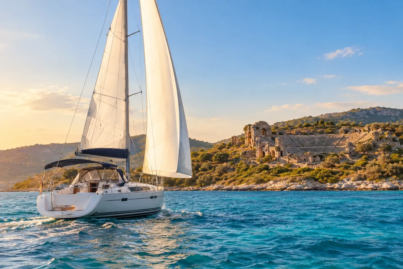
Sailing in Turkey offers some of the best cruising grounds in the Mediterranean, but it also brings a specific set of challenges that catch many skippers off guard. The top sailing mistakes to avoid in Turkey include ignoring local wind and weather patterns, mishandling paperwork and permits, neglecting waste and Blue Card rules, improper anchoring, underestimating navigation hazards, poor provisioning, and misunderstanding Turkish maritime law. Careful preparation prevents costly errors, and the difference between a smooth charter and a stressful one often comes down to planning before you leave the dock.
To avoid sailing errors Turkey, you need to treat this coast as its own environment, not a typical Mediterranean run. The meltemi, Turkish bureaucracy, and unmarked shallows each demand respect. This guide covers the seven most common mistakes charter crews make, so you can spend your holiday anchored in a quiet bay rather than dealing with fines, fouled anchors, or a hard grounding.
Essential Overview: Common Sailing Mistakes in Turkey
| Mistake | Description | Consequences |
|---|---|---|
| Overconfidence in Charts | Relying solely on published charts | Grounding, damage |
| GPS Alone in Shallows | Using GPS without other navigation | Grounding, damage |
| Underestimating Meltemi | Not preparing for afternoon winds | Turbulent anchorages, discomfort |
| Unmarked Shallows | Not checking for hidden reefs/shallows | Grounding, damage |
| Paperwork Errors | Issues with transit log, charter docs | Costly hassle, delays |
| No Stern Anchor | Mooring Mediterranean style without | Poor mooring, drift |
| Anchoring in Seagrass | Dropping anchor in seagrass meadows | Environmental damage, fines |
The most frequent sailing mistakes in Turkey are about navigation, mooring, and route-planning traps that trip up charter crews expecting a routine Mediterranean cruise. Overconfidence in published charts, relying on GPS alone in the shallows, and underestimating the afternoon meltemi are the most consequential errors year after year.
Turkey sailing challenges catch visitors off guard. The Aegean and Mediterranean coasts have long, indented shorelines with hidden reefs, and the popular gulfs like Gokova and Hisaronu have unmarked shallow spots that do not appear on cruising guides. The Turkish maritime authority requires documents including the transit log and charter papers, which can be a costly hassle for a simple paperwork slip. The weather is less forgiving than it looks on a calm morning. The meltemi, the seasonal northerly wind that builds in summer, turns many anchorages turbulent by afternoon.
Most common sailing mistakes in Turkey are small planning errors that snowball: mooring Mediterranean style without a stern anchor, anchoring in seagrass meadows, and unguarded swing room in a crowded bay. Recognizing these recurring issues prevents compounding problems that could block 20% of charter time.
How to Navigate Turkish Weather and Local Winds Safely
| Month | Region | Typical Wind Strength (Knots) | Recommended Sailing Times | Notes |
|---|---|---|---|---|
| Summer | Aegean Sea | 15-25 (Force 5-7) | Depart early, Anchor by 14:00 | Meltemi dominant, predictable daily cycle |
| Summer | Fethiye Eastward | 5-15 | Depart early, Anchor by 14:00 | Meltemi weakens, local thermal winds |
| Summer | Gulfs (Gokova, Hisaronu, Fethiye) | 15 (open bay), 30 (narrow channel) | Depart early, Anchor by 14:00 | Microclimates, funneling effects |
The meltemi is the dominant weather feature of the Turkish summer. This seasonal northerly wind builds through the morning, reaches force 5 to 7 by early afternoon, and dies down around sunset. For the Aegean Sea sailing season, it is predictable enough to plan around, but ignoring it turns a comfortable passage into a wet, hard-on-the-wind beat.
Plan your sailing day around the meltemi's daily cycle. The most reliable pattern is to depart early, anchor by 14:00, and use the afternoon for swimming, lunch, and shore excursions. Trying to push through the strongest hours of wind in exposed stretches, such as between Kos and Bodrum or across the open mouths of the gulfs, is one of the most common fatigue-inducing errors on the Turkish coast.
The Mediterranean sailing conditions along Turkey's southern shore are different. From Fethiye eastward, the meltemi weakens and the weather becomes more settled, but local thermal winds still build in the afternoon. The real hazard here is the microclimates within the gulfs: Gokova, Hisaronu, and Fethiye each have their own funneling effects, where the wind accelerates through mountain passes and around headlands.
A wind that reads 15 knots in the open bay can be 30 knots in a narrow channel or at the mouth of a valley. Local pilot books and weather apps that show wind at a single point will not capture these local winds Turkey sailors rely on understanding. Check the forecast for your specific route segment, not just the regional picture, and watch the mountains for signs of developing gusts.
Timing also matters for anchoring. In the meltemi season, the wind direction is consistent, but the afternoon surge makes many anchorages uncomfortable or untenable by 16:00. Anchor early, with enough scope for the full afternoon wind, not the calm morning conditions you set it in.
For marine weather Turkey forecasts, use the official Turkish State Meteorological Service and a dedicated marine weather app, and cross-reference them. The reliable summer pattern means you can plan a week ahead with confidence, but always have a backup anchorage in mind for the rare days when the meltemi exceeds its normal strength.
Paperwork Pitfalls: Permits, Transit Logs, and Customs in Turkey

| Document | Purpose | Where to Obtain | Renewal/Validation Steps |
|---|---|---|---|
| Transit Log | Vessel's passport; legal entry/exit | First port of entry | Port police stamp at each stop; check all entries |
| Crew List | Lists all persons on board | First port of entry (or charter company) | Update at nearest port authority if crew changes |
| Blue Card | Tracks waste oil/garbage disposal | First port of entry | Marinas stamp upon waste disposal; accumulate stamps |
Turkey's maritime bureaucracy is straightforward once you know the sequence. The three documents that matter most are the transit log, the crew list, and the Blue Card for waste disposal. Every foreign-flagged yacht entering Turkish waters needs a transit log, issued at the first port of entry. Your charter company usually handles this for a bareboat charter Turkey, but you still sign it, so check every entry before you do.
The transit log is your vessel's passport for the entire cruise. Port police will stamp it at each stop, and the stamps prove you entered and exited legally. Missing a stamp can trigger a fine at your final port, so make a habit of clearing in at every marina or harbor office you visit.
The crew list is a separate document, not part of the transit log. It must match the passports of everyone on board. If you swap crew mid-charter, update the list at the nearest port authority. Sailing on with an outdated crew list is one of the most common reasons for clearance delays.
The Blue Card tracks your waste oil and garbage disposal. You get it at your first port, and marinas stamp it when you hand over waste. Accumulating enough stamps avoids a deposit charge at the end, so don't skip the recycling station just because the bin is a walk away.
Customs procedures Turkey sailing are simple for charter yachts, but they punish carelessness. Do not arrive at a port outside official entry points, and never assume a quiet cove counts as clearance. Common mistakes include forgetting to submit the crew list before the port office closes and losing the transit log overboard. Keep both in a dry bag with your passports, and photograph every page as a backup.
The fix for most paperwork failures is routine. Check the documents at breakfast, clear in before you explore ashore, and keep the transit log where you can see it. Ten minutes of admin saves a full afternoon at the port captain's office.
Can I Visit Greek Islands from Turkey? What to Know
Yes, you can cross from Turkey to the Greek islands, but it is not as simple as sailing across the strait. The trip requires formal exit and entry clearance in both countries, and skipping a step can cost you a deposit or a fine.
For a yacht charter Turkey to Greece sailing itinerary, you must clear out of a Turkish port with the port authority and customs, then clear into Greece at an official port of entry. The Greek side will check your transit log, passports, and crew list, and may require a Schengen visa for non-EU nationals. The most common mistake is assuming a marina stamp is enough; it is not, and sailing into Greek waters without a proper exit stamp is treated as an illegal departure.
Plan the crossing for the morning when the meltemi is still light, and book a Greek port of entry that is an official customs stop. Keep your Turkish transit log stamped on departure and your Greek entry stamp on arrival, then repeat the process in reverse on the way back.
Avoiding Navigation Hazards on the Turkish Coast
| Hazard Zone | Coordinates | Avoidance Tips |
|---|---|---|
| Approaches to smaller bays | Varies | Use current charts, post a lookout, slow down |
| Headlands | Varies | Stand offshore, never cut between island/mainland unless marked |
| Marmaris approaches | Varies | Monitor AIS/radar for shipping |
| Bodrum approaches | Varies | Monitor AIS/radar for shipping |
| Fethiye approaches | Varies | Monitor AIS/radar for shipping |
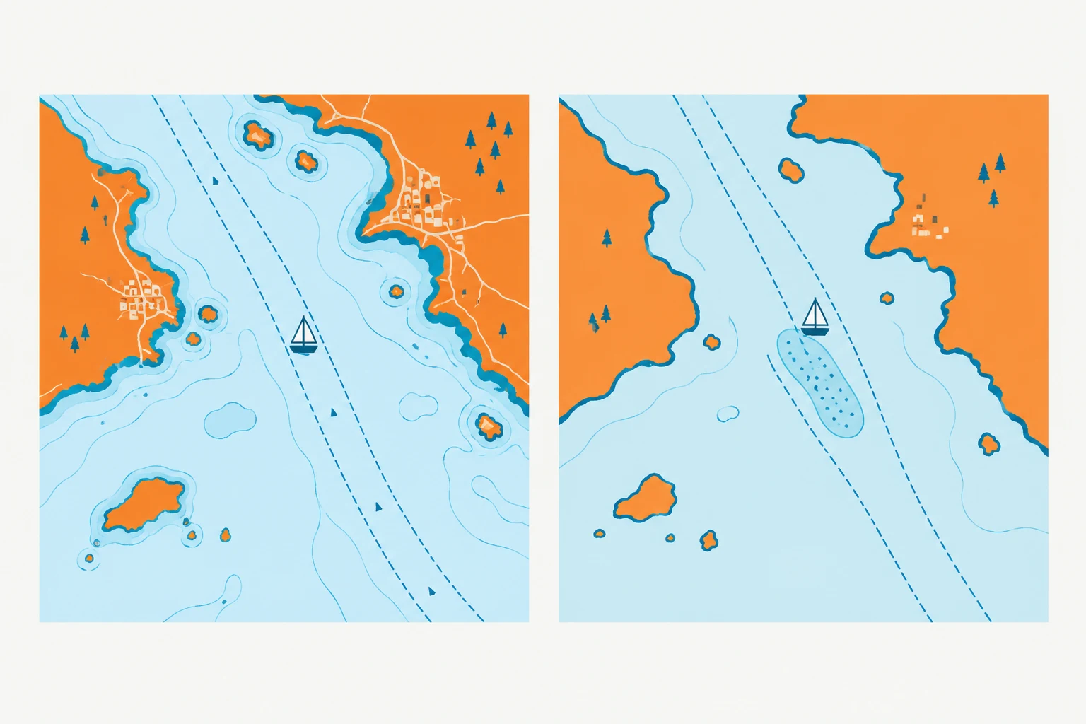
The most dangerous part of sailing in Turkey is rarely the open water; it is the final mile into a bay. The coast is studded with unmarked rocks and reefs that sit just below the surface, often extending further from headlands than the charts suggest. A GPS position that reads perfectly on the plotter does not guarantee a clean keel if your chart is outdated or you cut a corner too close.
Your first defense against a grounding is a current, official chart. Turkish waters are surveyed to varying standards, and a decade-old chart may be missing a shoal that a local fisherman knows well. Cross-reference your primary chart plotter with paper charts and pay specific attention to the approaches of smaller bays, where rocks are more likely to be unlit and unbuoyed. When in doubt, slow down and post a lookout on the bow.
Electronic aids are useful, but they have blind spots. Your depth sounder is only reliable if it is calibrated and you are reading the correct transducer offset. Do not rely on AIS or radar to keep you clear of rocks; those systems are for collision avoidance with other vessels, not submerged hazards. Use them to monitor the busy shipping lanes along the Turkish coast, particularly near the approaches to major ports like Marmaris, Bodrum, and Fethiye, where commercial traffic and ferries cross your path.
Local knowledge is the best chart you can carry. The Turkish coast has a strong cruising culture, and the sailors and charter companies operating there know where the unmarked dangers hide. Ask the marina staff or your charter base about specific hazards in the gulf you are entering; a verbal warning about a reef off a certain cape is worth more than any digital overlay. When sailing a new route, always plot a course that stands offshore from the headlands, and never cut between an island and the mainland unless the passage is clearly marked and well-charted.
Waste Management and the Blue Card: Critical Rules for Sailors
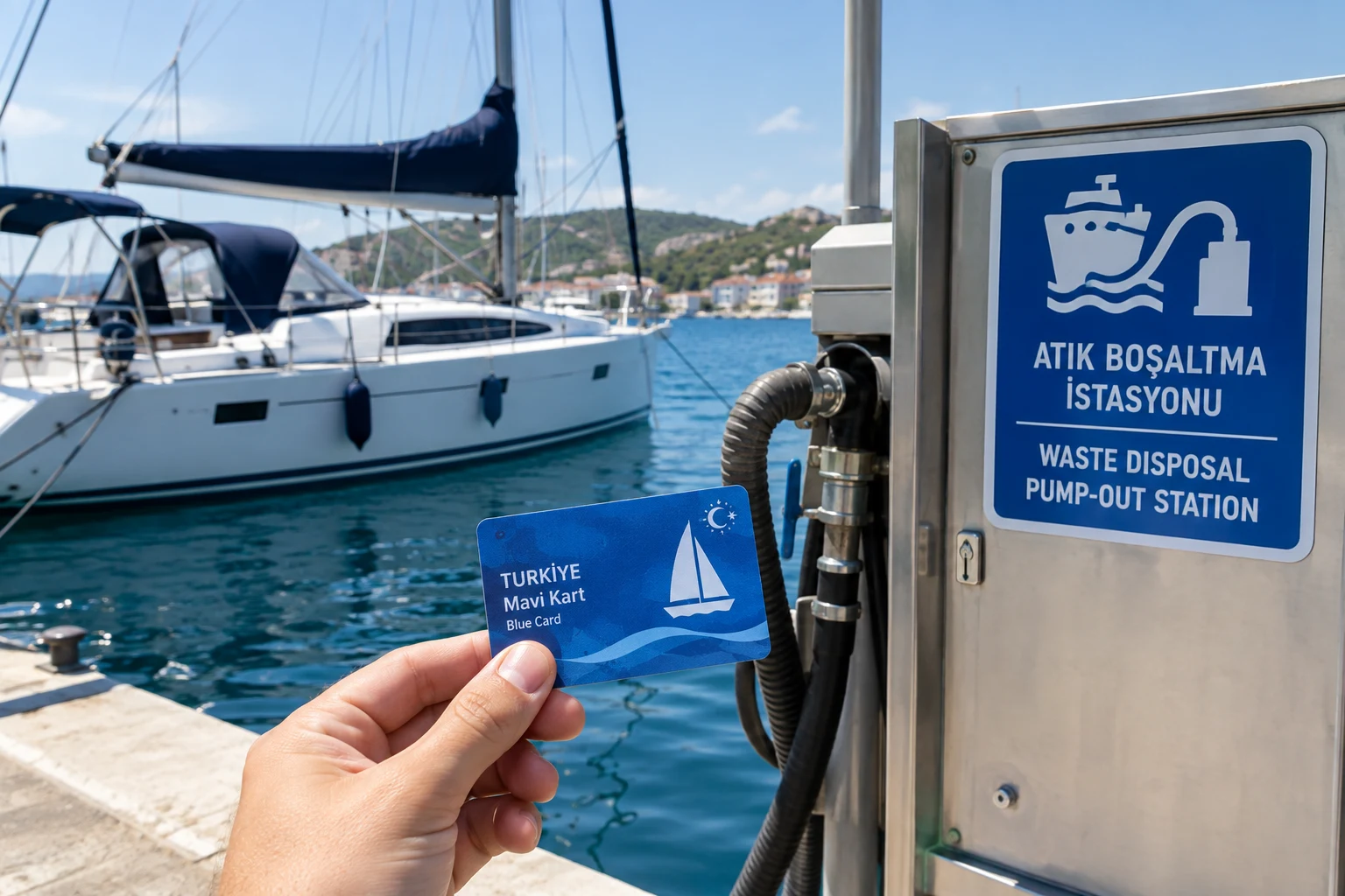
The Blue Card is Turkey's mandatory waste tracking system for all yachts, chartered or private. It is a document that records every waste disposal you make at an authorized facility, and without it, you cannot clear out of Turkish waters. The card is issued at your first port of entry, and it is checked at every subsequent port.
Turkey has tightened enforcement of its environmental rules in recent years, particularly around the discharge of black water (sewage) and gray water (sink and shower runoff). Discharging either within Turkish territorial waters is illegal and can result in fines that far exceed the cost of a pump-out at a marina. The Blue Card system is the proof that you disposed of waste properly, and missing entries are treated as evidence of illegal discharge.
To stay compliant, use the pump-out facilities at every marina that offers them, and always get your Blue Card stamped or filled in. Keep the card with your transit log, not buried in a locker, because inspectors will ask for both together. A charter base will usually handle this for you on a skippered charter, but on a bareboat charter, the responsibility sits with the skipper. Treat the Blue Card like the transit log: a small piece of paperwork that can end a trip if it goes missing.
Anchoring and Mooring: What Not to Do in Crowded Turkish Bays
| Anchorage Type | Recommended Anchoring Method | Minimum Scope Ratio | Restrictions | Notes |
|---|---|---|---|---|
| Crowded Bays | Anchor on sand, use mooring buoy | 1:5 | Posidonia seagrass, navigation channels, ferry routes, military zones | Mooring buoys often free/low-cost |
| Protected Seagrass Meadows | Use mooring buoy | N/A | Anchoring prohibited | Fine for anchoring on seagrass |
Crowded Turkish anchorages punish sloppy technique faster than almost any other Mediterranean destination. The most common anchoring mistakes in Turkey are dropping the hook without enough scope, ignoring the unwritten rules of bay etiquette, and letting the anchor drag across a protected meadow of posidonia seagrass.
Poor anchoring technique is the root of most problems. In the summer meltemi, the wind can swing 180 degrees as it funnels over headlands, so a 1:5 scope ratio is the minimum you should consider. In 10 meters of water, that means paying out at least 50 meters of chain. Many charter skippers shortcut this in shallow bays and pay for it at 03:00 when the boat drags toward the rocks or a neighboring yacht.
The etiquette rules in Turkish bays are simple but strict. The first boat in an anchorage chooses its spot; latecomers must not crowd in so close that swing circles overlap. If you arrive after dark or after the afternoon calm settles, anchor further out and dinghy to shore rather than wedging yourself between two already-settled yachts.
Anchoring in restricted areas is a fast way to earn a fine. The Turkish Coast Guard takes a hard line on anchoring too close to navigation channels, ferry routes, and military zones. In many bays along the Gokova and Hisaronu gulfs, portions of the seabed are marked as protected seagrass meadows where anchoring is prohibited. You are expected to use the mooring buoys provided instead. These buoys are often free or low-cost and are maintained by local municipalities or the national parks authority.
Check with the nearest marina in Turkey or the local harbor master if you are unsure whether a bay is protected. A short VHF call to the harbor office or a glance at your pilot book will tell you where the buoys are and which areas are off-limits.
When you do anchor, set the anchor properly. Reverse hard on the engine to bury the hook, then snorkel or watch the chain to confirm it holds before you shut down. In crowded Turkish bays, a poorly set anchor is not your problem alone. It becomes the problem of every yacht anchored downwind of you.
Provisioning and Trip Preparation: Avoiding Costly Oversights
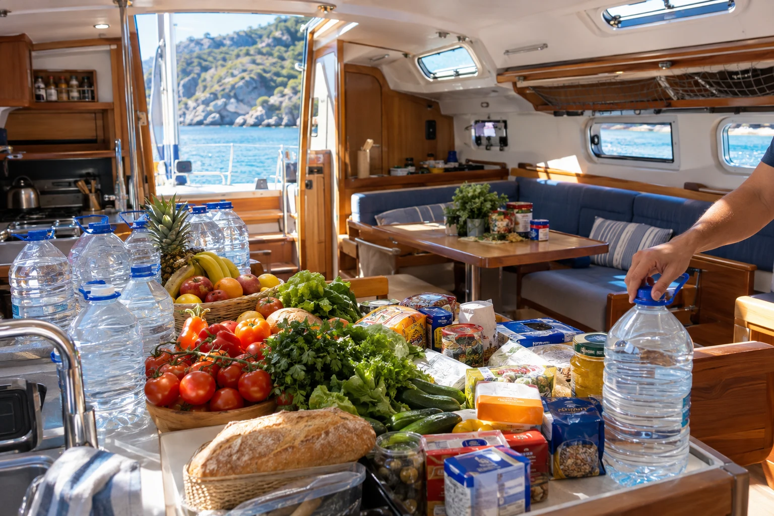
The most common provisioning mistake on a bareboat charter Turkey trip is underestimating how much water and food the crew actually consumes. Plan for at least 4 liters of drinking water per person per day, plus cooking and washing water. Turkish marinas and larger towns have supermarkets, but the remote coves along the Lycian coast often have no supply options at all.
Relying on remote supplies is a trap for first-time sailors. The charming village markets you see on charts may be seasonal, closed on random weekdays, or stocked with little more than bread and tomatoes. Stock up fully in major supply hubs like Marmaris, Gocek, Fethiye, or Bodrum before heading into the gulfs.
Critical spares are easy to forget on a bareboat charter because the boat is not yours. Carry your own: engine fuel filters, impellers, a spare winch handle, fuses, and a basic tool kit. Bring a handheld VHF and a backup GPS or chart plotter app, since the charter unit's electronics can fail. A spare rope and extra anchor snubber line cost little and solve most mooring problems.
Fresh water is the hidden constraint. Many Turkish bays have no shore supply, and charter tanks hold roughly 300 to 500 liters. Use marina water at every opportunity, even if the tank is half full. In remote anchorages, ration washing and cook with seawater where safe.
Finally, plan for the meltemi's schedule in your provisioning. You will be anchored by early afternoon most days, so plan lunches and dinners around what you have on board. The evening is the time to explore ashore, not to hunt for supplies.
Understanding Turkish Maritime Law and Local Customs
Turkish maritime law changed significantly for visiting sailors in recent years, and sailing without updated paperwork is the fastest way to turn a dream cruise into a fine. The most important change is the mandatory insurance requirement: third-party liability insurance is now compulsory for all yachts in Turkish waters, and you may be asked to show proof when you clear in at your first port of entry. Beyond the transit log, crew list, and Blue Card, charter companies now routinely require the skipper to carry a valid license or ICC certificate, so confirm what your base provides before you cast off.
Cultural mistakes are just as likely to ruin a peaceful anchorage as a legal one. Turkish maritime law and local custom both treat noise seriously, and music carries across calm water for hundreds of meters. Keep music at a conversational level and drop it entirely after 23:00; in many popular bays, the coast guard and local authorities do act on complaints from shore residents. Respect the call to prayer from nearby mosques by lowering your voice and volume during the five daily prayer times, and never anchor directly in front of a beach restaurant or private jetty expecting to be welcome.
Protected sites are non-negotiable. Turkey enforces strict rules on underwater archaeological sites and posidonia seagrass meadows, and anchoring on either can bring heavy fines. In designated marine protected areas you must use the provided mooring buoys, even if the anchorage looks empty. If you are unsure whether a bay is protected, check with your charter base or the local harbor master before dropping the hook.
Learning a few Turkish phrases like "tesekkurler" (thank you) and "merhaba" (hello) goes a long way. Locals appreciate the effort, and a friendly greeting before you ask for a berth or a pump-out often smooths over the very bureaucracy that trips up careless sailors.
FAQ: Sailing Mistakes and Safety in Turkey
What is the most common sailing mistake in Turkey?
Underestimating the afternoon meltemi wind is the most common error. Skippers plan a long passage for the day, only to find themselves beating into a force 6 by 15:00. The fix is simple: depart at first light and anchor by early afternoon, when the wind is at its strongest.
Are there hidden hazards along the Turkish coast?
Yes. The coast has many hidden reefs and unmarked shallow spots, particularly in the gulfs of Gokova and Hisaronu. Over-reliance on GPS and outdated charts causes most groundings. Cross-reference every electronic plotter with a current paper chart and post a lookout on the bow when entering an unfamiliar bay.
What is the biggest weather-related sailing hazard on the Turkey coast?
Local microclimates, not the regional forecast. Thermal winds funnel through the gulfs and can blow far stronger than the area forecast predicts. In the Mediterranean region east of Fethiye, these local winds build quickly and without warning.
How should I anchor safely in Turkey?
Anchor early with a minimum scope of 1:5, calculated for the afternoon wind, not the morning calm. The wind will swing your boat during the day, so allow room to swing without hitting a neighbor. Always identify a backup anchorage before you drop the hook.
What paperwork mistakes do yacht charter crews make in Turkey?
The most expensive mistake is leaving a port without an exit stamp on the transit log. The transit log is the vessel's passport, and every stop must be stamped. Skippers also forget to update the crew list when someone joins or leaves, which causes problems at the next customs check.
How can I avoid fines related to waste and the environment?
Never discharge black or gray water in Turkish waters; it is illegal. Use marina pump-out facilities and get your Blue Card stamped at every disposal. Carry the card at all times, because inspectors check it at random.
What should I do if I get into trouble?
Contact the nearest marina or harbor master by VHF. Turkish marina staff are experienced and can advise on local conditions, mooring, and paperwork. For a medical emergency, call the coast guard on VHF channel 16.
Conclusion: Avoiding Common Sailing Mistakes in Turkey
The common thread in most Turkish sailing mishaps is that none of them are dramatic or exotic. They are routine, predictable, and entirely preventable: leaving an hour late and fighting the meltemi, trusting a chart over your eyes in a shallow bay, or skipping a stamp at a port office.
Plan each day around the wind, not the distance. Treat every GPS position as a suggestion until your own eyes confirm the water depth. Keep the transit log and crew list in order, one stamp at a time, and you have already avoided the majority of fines and frustrations this coast can produce.
Book your first port of entry now and end each sailing day by 14:00. That single habit will save you more trouble than any other piece of preparation.
Explore next
Destination guide
Turkey
Turkey's Aegean and Turquoise Coast offer some of the best sailing in the Mediterranean. Here's where to base your charter and what to expect.