Full Description & Details
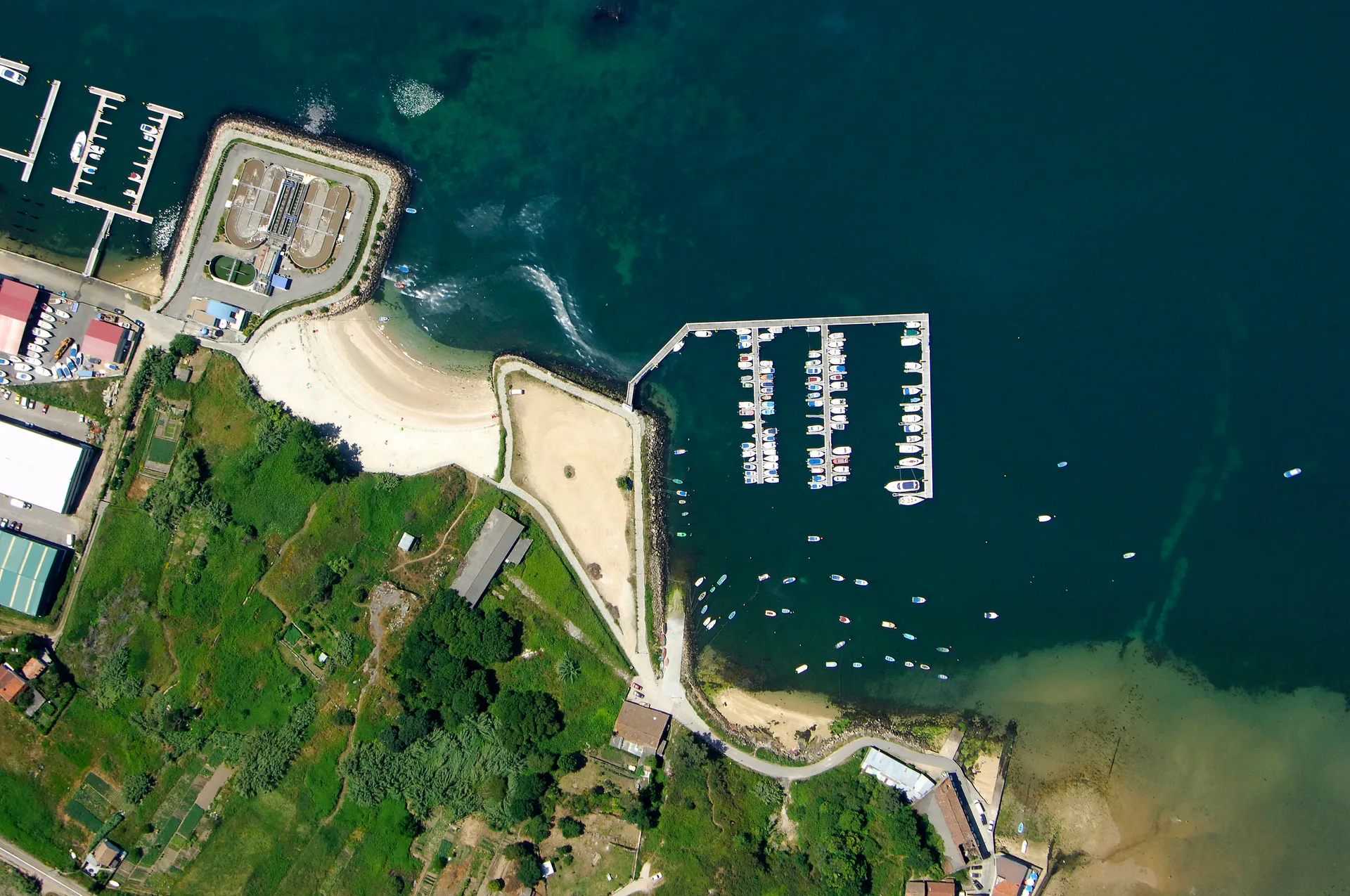
Mersin Korfezi is an anchorage located on the Aegean coast of Turkey, within the sailing route between Ayvalik and Kusadasi. It is a natural bay, identified as a multipolygon feature on navigational charts. The anchorage offers a straightforward stopover for cruising sailors transiting this popular stretch of Turkish coastline, with no marina infrastructure or dedicated berthing facilities present.
The holding ground is mud, which generally provides good anchor holding in moderate conditions. Depths across the anchorage range from 5 to 7 meters, making it suitable for a variety of cruising yachts and small to medium-sized vessels. There are no moorings or designated berths; vessels anchor freely in the bay. The seabed composition and depth range are the primary navigational characteristics documented for this location.
Facilities at Mersin Korfezi are minimal, as it is an open anchorage rather than a developed harbor. There are no reported fuel docks, water supplies, or shore-side services directly at the anchorage. Nearby berthing facilities are located approximately 1 to 2 kilometers away, and the closest marinas are at Alacati and Cesme, which offer fuller services including mooring, fuel, and repairs. Sailors should plan to be self-sufficient while anchored here.
Safety considerations are limited by the available data. The anchorage is exposed to some degree, given its open bay nature, and holding in mud can be less secure in strong winds or during sudden squalls. The best season for anchoring is typically the summer cruising months, when Aegean weather is more settled. There are no reported restrictions on anchoring, but sailors should check local notices and approach with caution, especially in changing weather conditions.
How to get there
Approach Mersin Korfezi from the open Aegean, using the bay's natural entrance. The documented position is approximately 38 degrees 13.145 minutes North, 26 degrees 25.323 minutes East. There are no reported navigational hazards or specific waypoints marked for the anchorage, so rely on standard charted depths and visual bearings.
No VHF channel is listed for the anchorage; contact nearby marinas if needed. Land access is via the surrounding Turkish coastline, with the nearest significant towns and marinas at Alacati and Cesme, both within a short distance. These locations provide road connections and airport access through Izmir.
There are no formal port entry procedures for anchoring here, as it is not a designated port of entry; sailors should clear in at a nearby official port if arriving from abroad.
Frequently Asked Questions
What is the depth range at Mersin Korfezi anchorage?
The depth at Mersin Korfezi ranges from 5 to 7 meters, suitable for most cruising yachts.
What type of seabed is found at Mersin Korfezi?
The seabed at Mersin Korfezi is mud, which generally provides good holding in calm conditions.
Are there any berthing facilities at Mersin Korfezi?
No, Mersin Korfezi is an open anchorage with no dedicated berths or moorings; nearby berthing facilities are located about 1 to 2 kilometers away.
What is the closest marina to Mersin Korfezi?
The closest marinas to Mersin Korfezi are Port Alacati Marina and Setur Cesme Marina, both offering fuller services.
Is there a VHF channel for Mersin Korfezi?
No VHF channel is listed for Mersin Korfezi; sailors should use standard hailing channels or contact nearby marinas.
Explore Turkey
How Much Does It Cost to Charter a Yacht in Turkey?
Real yacht charter costs in Turkey by boat type, season and region — bareboat, skippered, crewed and gulet prices, plus what's included and what costs extra.
Eco-Friendly Sailing in Turkey: Sustainable Tips
Sail Turkey's coast responsibly: Zero Waste Blue rules, protected marine areas, seagrass-safe anchoring, and practical tips to cut plastic and fuel use.
Bareboat Sailing in Turkey: Requirements and Tips
Everything you need to bareboat charter in Turkey: accepted licences, the Transit Log, VHF rules, no-go zones, and practical tips for a smooth check-in.
Top 10 Sailing Destinations in Turkey: Ultimate Yacht Charter Guide
Discover the top 10 sailing destinations in Turkey, with expert tips on routes, marinas, and when to go. Plan your perfect sailing holiday along the Turkish Riviera.
Sailing Season in Turkey: Best Times and Weather by Month
Discover the best time to sail Turkey, with month-by-month sailing conditions, weather, crowds, and costs for yacht charters along the Turkish Riviera.
More sailing guides
Yacht Charter Provisioning Guide: Expert Tips & Checklists
Plan your sailing holiday like a pro with our yacht charter provisioning guide—food lists, meal planning, local market tips, and essential advice for every itinerary.

Best Yacht Type for Group Charters: How to Choose
Discover the best yacht types for group charters, from family reunions to corporate events. Compare sailing yacht options, capacity, cost, amenities, and legal limits.
What Information Is Needed to Book a Sailing Yacht Charter?
Discover the key information, documents, and requirements needed to book a sailing yacht charter. Learn what details charter companies need for a smooth reservation.
Yacht Charter Deposit Insurance: What It Covers & Why You Need It
Understand yacht charter deposit insurance: what it covers, costs, differences from security deposits, and how it protects your sailing holiday or commercial charter.
Related places
Azmak Koyu
Beyaz Kayalar
Böğürtlen Körfezi
Bostanlı Barınağı
Çeşme Marina
Davutlar Limanı
Akaçlar Koyu
Aksazlar Koyu
Akvaryum bay
Adaköy Marina
Alanya Marina