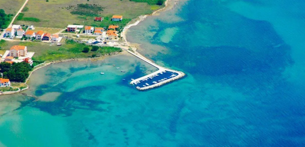
Full Description & Details
Port of Sibenik occupies the flooded mouth of the Krka River in central Dalmatia, 10 kilometres inland from the open Adriatic. The port extends 10 kilometres in length, with widths ranging from 300 to 1200 metres and depths between 8 and 40 metres. Natural protection from wind and waves makes it one of the best-sheltered harbours on the Croatian coast. The port is accessed through the St. Ante channel, 2700 metres long and 120 to 300 metres wide, allowing smooth navigation for vessels up to 50,000 DWT.
The Vrulje Quay passenger terminal provides five berths with a combined quay length of 515 metres. Berth capacities accommodate vessels up to 260 metres LOA with drafts to 9 metres. Two cruise ships can be handled simultaneously: one up to 260 metres and another up to 200 metres. The quay is equipped with 30 bollards and 28 cylindrical fenders spaced at 20-metre intervals. Depths at berths range from 8 to 10 metres. The port can also accommodate vessels at anchorage: the outer anchorage lies 1 to 2 nautical miles southeast of Zlarin island, while the inner anchorage is located west of Krapanj island between Drvenik island and the Solaris resort.
Services include pilotage (compulsory, monitored on VHF channel 12), tugs, bunkering, water, provisions and garbage disposal. Ship repair is available for vessels up to 70 metres. The terminal is 500 metres from Sibenik city centre, 300 metres from the railway and bus stations, and offers parking for 20 buses and 350 cars. Split Airport lies approximately 50 kilometres south; Zadar Airport is 80 kilometres north.
Weather conditions include strong bura (northerly) and jugo (southerly) winds. Sea currents in the channel range from 0.5 knots during weak Krka River inflow to 3 knots during strong inflow. Tidal range averages 0.2 to 0.4 metres, though storm winds and heavy rainfall can raise levels up to 1 metre. The allowed speed through the channel is 6 knots.
How to get there
The entrance to the St. Ante channel is identified by Jadrija lighthouse (red) on the western side, the lighthouse on Cape Rocni (green), and the tower at Fortress Saint Nikola. The channel is 1.4 nautical miles long with an entrance width of 220 metres, narrowing to 140 metres at its tightest point. Channel depths range from 20 to 40 metres.
A permanent outgoing current flows toward the entrance at speeds between 0.5 knots in summer and 3 knots in winter, with an average of 2 knots. The maximum allowed speed through the channel is 6 knots. Pilotage is compulsory and monitored on VHF channel 12.
Ships approaching from the Murter Sea can enter through three passages: Logorunska Vrata (leading to the northern part of Prvic island), Sibenska Vrata (between Prvic and Zlarin islands), or between Zlarin island and Dvainka islet. The most common route is through the channel between Prvic and Zlarin islands when approaching from the south during southerly winds. The recommended passage is between Zlarin island and Dvainka islet.
The port is 500 metres from Sibenik city centre, with road access via the A1 Zagreb-Split highway.
Frequently Asked Questions
How many berths does Port of Sibenik have?
Port of Sibenik has 5 berths at the Vrulje Quay passenger terminal.
What is the maximum draft at Port of Sibenik?
The maximum draft allowed at Port of Sibenik is 9 metres.
What is the maximum LOA at Port of Sibenik?
Port of Sibenik can accommodate vessels up to 260 metres LOA.
What VHF channel does Port of Sibenik monitor?
Port of Sibenik monitors VHF channel 12 for pilotage, which is compulsory.
Can yachts stay overnight at Port of Sibenik?
Yes, Port of Sibenik operates 24 hours and allows overnight stays.
What facilities are available at Port of Sibenik?
Port of Sibenik provides fuel, water, provisions, garbage disposal, and ship repair for vessels up to 70 metres.
Where can vessels anchor near Port of Sibenik?
The outer anchorage is located 1 to 2 nautical miles southeast of Zlarin island. The inner anchorage is west of Krapanj island between Drvenik island and the Solaris resort. The best anchorage within the port is WSW and SSW of the cathedral, with Port Authority approval required.
More sailing guides
Bareboat Sailing in Spain: Requirements and Licences
Everything you need to bareboat charter in Spain: accepted licences, flag-state rules, VHF requirements, and what to do if yours isn't accepted.
Yacht Charter Cost in Spain: What to Expect and How to Save
Real yacht charter costs in Spain by boat type, season, and region, plus what's included, hidden fees, and practical ways to cut the price.
How to Charter a Yacht in Spain: A Step-by-Step Guide
A step-by-step guide to chartering a yacht in Spain: choosing a charter type, budgeting, licences, booking, and what to expect once you're aboard.
Yacht Charter Provisioning Guide: Expert Tips & Checklists
Plan your sailing holiday like a pro with our yacht charter provisioning guide—food lists, meal planning, local market tips, and essential advice for every itinerary.

Best Yacht Type for Group Charters: How to Choose
Discover the best yacht types for group charters, from family reunions to corporate events. Compare sailing yacht options, capacity, cost, amenities, and legal limits.
What Information Is Needed to Book a Sailing Yacht Charter?
Discover the key information, documents, and requirements needed to book a sailing yacht charter. Learn what details charter companies need for a smooth reservation.
Yacht Charter Deposit Insurance: What It Covers & Why You Need It
Understand yacht charter deposit insurance: what it covers, costs, differences from security deposits, and how it protects your sailing holiday or commercial charter.
Related places
Vrulje
Bobovišća

Drvenik Veliki
Dugi Rat Marina
ACI Marina Jezera
ACI Marina Milna
ACI Marina Palmižana
Birthday Bay (Stupica Vela)
Konoba Matteo
Lemes
Luka Mrtinovik